With the downpour last night, I got thinking about what the course is going to look like on Thursday. I was down to the driving range on Monday and there was standing water on 1, 13 and 14. I went online to check to see what Tanner looks like by the maps.
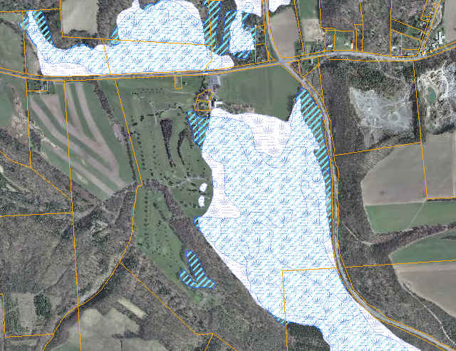
The first map should be no shocker to all of us. There is a New York State DEC and Federal Wetland surrounding Tanner. The white portions are the DEC Wetland, the blue is the Federal Wetland.
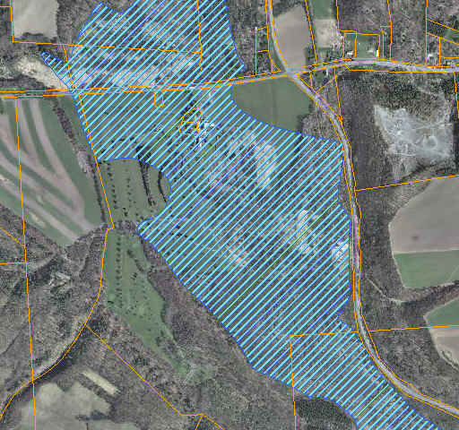
The final look at the map shows floodplains. While this isn’t surprising that the course has floodplains on it (think 1, 13, 9 after a rainy day), what is surprising is the extent of it. Looks like the only holes not in the floodplain is 3, 4, 5, 6, 7, 16 and only half of 12, 15.


